Signals are pointing to the re-emergence of El Niño. If this is officially declared, what will this mean for Australians? And what does it have to do with climate pollution from coal, oil and gas?
Watch climate scientist and Councillor David Karoly explain how climate change interacts with El Niño, what Australia can expect, and the key risks for our communities and environment:
What’s El Niño Again?
El Niño and La Niña are opposite phases of the El Niño–Southern Oscillation (ENSO), one of the most powerful climate patterns on Earth. It is a coupled atmosphere-ocean phenomenon, meaning it is driven by complex interactions between ocean temperatures and atmospheric circulation.
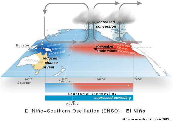
During an El Niño event, the south-easterly trade winds weaken, failing to maintain the usual warm waters to the north of Australia. This causes localised ocean cooling near Australia and leads to warmer-than-usual waters off the Pacific coast of South America. This shift in ocean temperatures releases significant heat into the atmosphere, which dramatically alters weather patterns worldwide.
The specific impacts of El Niño include:
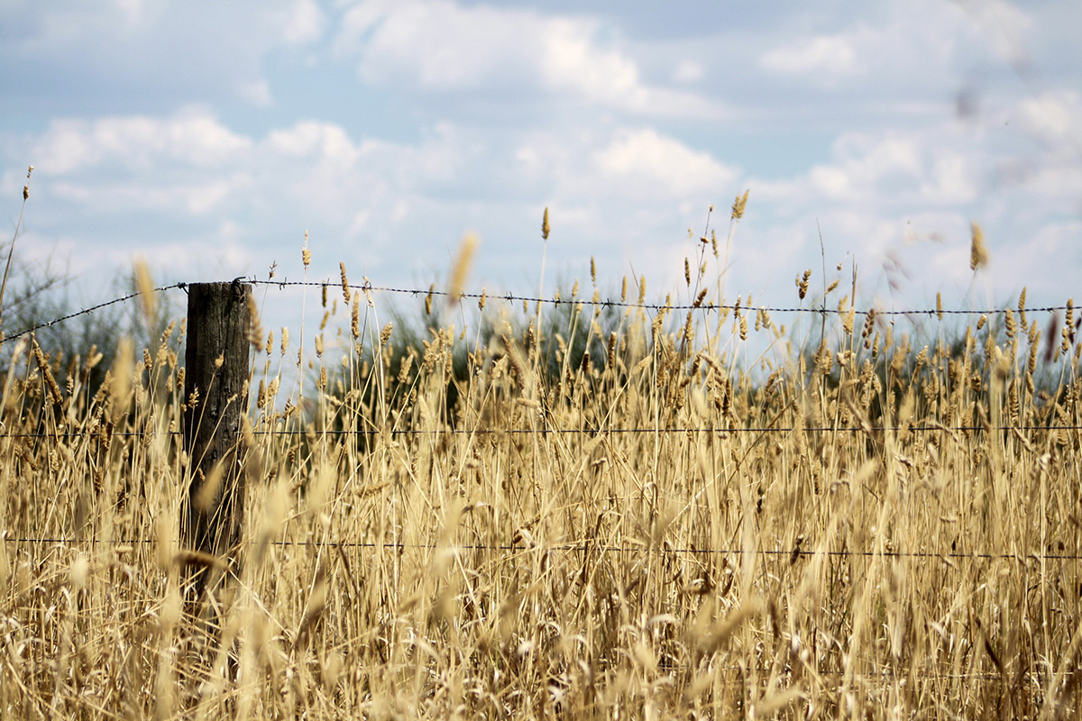
- Hot and dry weather in Australia, Indonesia, and parts of southern Asia, because rainfall shifts away from these areas and towards the eastern Pacific. In Australia this brings an increased risk of severe droughts, extreme heatwaves, and bushfires, particularly in the eastern regions.
- Increased rainfall in other parts of the world, including southern South America, the southern United States, the Horn of Africa, and central Asia.
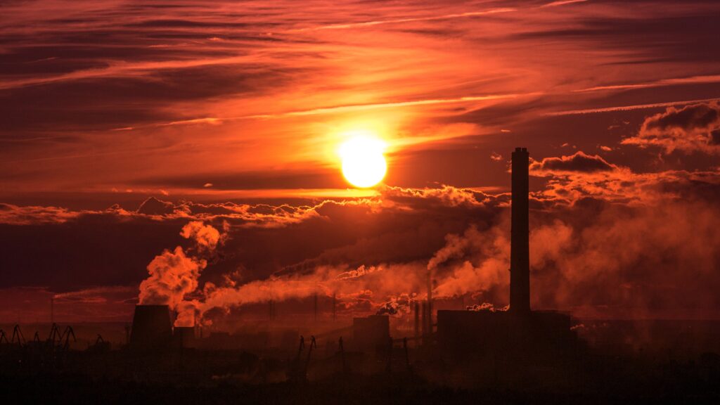
While El Niño is a natural cycle, climate pollution from coal, oil and gas is amplifying its effects. Because our atmosphere and oceans are already operating from a 1.5°C hotter baseline, the extra trapped energy and moisture “supercharge” El Niño and fuel compounding extreme weather events.
In short, every El Niño is going to be hotter than the last because of climate pollution.
Where Does the Name Come From?
The term “El Niño” originated in the 1800s with fishermen in coastal Peru. Every few years, these fishermen noticed the arrival of a warm ocean current that drastically reduced their fish catches; hurting their local food supply and livelihoods. Because this warm water typically appeared around Christmas time, they named the phenomenon “El Niño” which means “the boy” in Spanish in reference to the birth of Christ.
How Do We Monitor El Niño?
Scientists and national weather agencies like Australia’s Bureau of Meteorology monitor sea surface temperatures and atmospheric pressure changes, which dictate whether the world experiences the typically hotter El Niño phase or the cooler La Niña alternative.
In the ocean, ENSO is most commonly monitored through observed sea surface temperatures within a region of the central and eastern tropical Pacific known as NINO3.4. In the atmosphere, ENSO is monitored via the Southern Oscillation Index (SOI), a measure of atmospheric circulation that takes the difference of atmospheric pressure between Darwin and Tahiti.
An El Niño is typically declared by weather agencies like Australia’s Bureau of Meteorology when ocean temperatures rise more than 0.8°C above average and the SOI falls below −8. Events that stay close to these threshold values are generally classified as moderate to weak, while those that greatly exceed them are referred to as strong.
Several leading weather services are predicting Pacific sea temperatures could surge 2°C or more above average later this year. — exceptionally high projections. Just three events (1982/83, 1997/98 and 2015/16) have breached 2°C since the first major El Niño was recorded in meteorological records in 1877/78. But it is still too early to declare an El Niño, never mind accurately determining its strength.
The declaration of an El Nino – whether it is weak or strong – does not guarantee specific types of severe weather events are on the way. But now that all weather is occurring on a hotter planet, it loads the dice towards greater impacts.
Who declares an El Nino?
Weather agencies like Australia’s Bureau of Meteorology and the US National Oceanic and Atmospheric Administration have the responsibility of officially declaring an El Niño.
Agencies wait for indicators to align before officially upgrading an El Niño watch to an active event. These key criteria include:
- Sea Surface Temperatures: Waters in the central to eastern equatorial Pacific must consistently warm to at least 0.8°C above average.
- Atmospheric Response: The atmosphere must react to this warming, which is measured using the Southern Oscillation Index (SOI) and the SOI must consistently read -0.8 or less. Sustained negative values typically indicate weaker trade winds and a shift in cloud patterns away from Australia and toward the central Pacific.
- Climate Models: Forecasts from major meteorological institutions globally must predict the sustained continuation of these conditions through the coming seasons.
If El Niño indicators remain at or above existing levels for several weeks, then an El Niño will be considered underway, and is likely to persist until at least summer in 2026-27.
Climate pollution is supercharging all weather
Climate pollution amplifies an El Niño’s impacts because a warmer ocean and atmosphere increases the availability of energy and moisture for extreme weather events such as heatwaves and heavy rainfall.
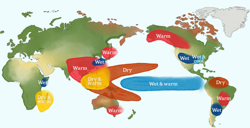
Each El Niño event is unique in terms of its development, geographic spread and impacts. However, it is typically associated with increased rainfall in parts of southern South America, the southern United States, the Horn of Africa and central Asia, and hotter and drier conditions in Australia, Indonesia, and parts of southern Asia.
Short-term fluctuations in temperature / rainfall are often related to climate drivers such as El Niño or La Niña. But climate change is cranking up the volume as each event occurs in a much hotter and more energetic world because of climate pollution from fossil fuels.
“What’s striking is that global temperatures during recent La Niña years were warmer than El Niño years just a few decades before. “Cold years” today are hotter than “hot years” not too long ago.” Samborska and Ritchie 2025.
Figure 3: We are entering an El Niño starting from a baseline that is 1.5°C hotter. Source: OurWorldinData.org/climate-change.
Data shows the temperature increases for La Nina, Neutral and El Nino ENSO phases compared to average monthly temperatures from 1991 to 2020. Climate pollution has increased global temperatures by 1.5°C from a pre-industrial baseline (1850-1900).
No one can separate natural cycles from climate change anymore. We are entering an El Niño starting from a baseline that is 1.5°C hotter. The difference between the El Niño we experienced in 2015/16 and any that is declared today is more than a decade of additional climate pollution that’s trapping more heat in our atmosphere.
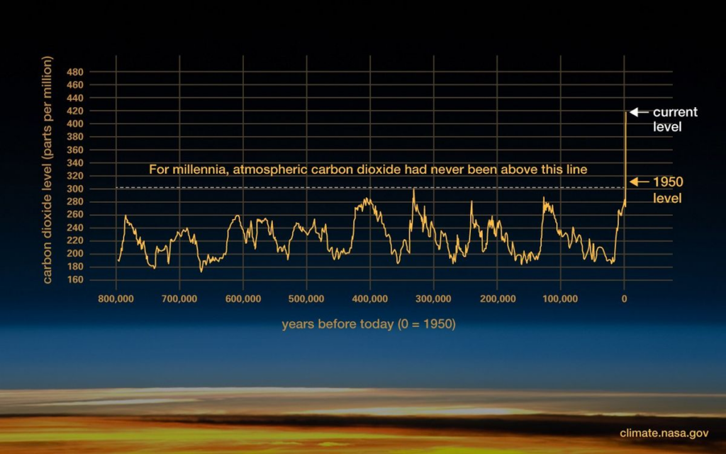
Because global temperatures are rapidly rising – the 11 hottest years on record have all occurred since 2010 – the additional presence of an El Niño will almost certainly set new records.
Impacts to watch out for
Australians are reeling from climate disasters that are hitting harder, faster and closer together. Last summer was one of climate whiplash where communities flung from one extreme weather event to another. From sweltering through record-breaking temperatures, like Victoria’s January 2026 heatwave, only to be hit by catastrophic bushfires and flash flooding a few weeks later.
There are many, significant consequences to worsening extreme weather and an El Niño.
Australians should prepare early for the combination of El Nino and climate change, and watch out for:
- Their mates; many people can be impacted by heat, drought, fire and even rising food prices during El Nino.
- Soils and vegetation drying out, and plants and animals in distress;
- A longer frost season due to clearer skies overnight;
- Rivers, dams, lakes and water catchment levels reducing;
- Fire seasons starting earlier, and finishing later;
- A late onset to the Australian monsoon, with fewer but more intense tropical cyclones;
- Extreme heat arriving sooner, and becoming more frequent; and
- Marine heatwaves harming fish stocks and bleaching our coral reefs.
This is by no means an exhaustive list of consequences, and any of these will have serious implications for our communities.
How we can prepare
We can’t control if an El Niño is declared in combination with higher levels of climate pollution. But we can prepare early and watch out for many of the potential impacts.
- Stay Connected and Monitor Conditions: Regularly check forecasts and fire ratings via the Bureau of Meteorology (BOM) and local alerts from Fire and Emergency services like NSW Rural Fire Service or Victoria’s Country Fire Authority.
- Have your Bushfire Plan in place.
- Prepare your property: Cut back overhanging branches, clear dry vegetation, and keep grass short around your property. Clean gutters of leaves and install metal gutter guards to prevent flying embers from igniting your roof.
- Manage Water by installing water tanks, fix leaks and use water wisely.
- Prepare and review financial & insurance policies. Contact your provider to confirm that your home, contents, and vehicle insurance policies adequately cover bushfire or heat damage.
- Prepare your cooling systems (like air conditioners) now and consider energy-saving upgrades such as solar panels to manage rising electricity bills during prolonged heatwaves.
We need to plan for, and adapt to, climate impacts now and in the decades ahead. The severity of impacts on Australians and our environment will depend on the speed at which global greenhouse gas emissions can be reduced.