Back in September ‘23, when the Bureau of Meteorology declared both an El Niño event and positive Indian Ocean Dipole were underway, Australians were warned to prepare for some hot and dry months ahead and the return of dangerous fire conditions. 2023 was already well on track to be the hottest year on record globally, and the Northern Hemisphere summer had been marked by extreme heatwaves and record-breaking fire seasons.
While much of the centre and west of Australia has indeed been hot and dry, for those in the eastern states, summer 2023-24 has been shaping up a little differently than many people expected.
So what has changed since September? And what should we expect for the rest of summer?
Our summer so far
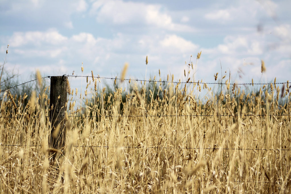
Early to mid spring felt very typical of El Niño. The August to October period was Australia’s driest three months on record since 1900. Fires started early in Victoria and New South Wales, and Queensland lost more homes to fire than the state had lost during the devastating 2019-20 ‘Black Summer’ fires.
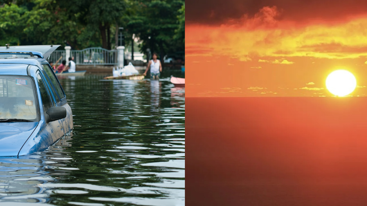
By late spring the picture began to change, and November saw above-average rainfall in Victoria and New South Wales. The first days of summer saw heavy downpours continue in eastern Victoria and southern New South Wales, leaving communities wading through flood waters. Some had only just finished battling fires. Up north, Cyclone Jasper, a powerful and long-lasting tropical cyclone, dumped enormous volumes of rain over Far North Queensland. The Daintree River peaked at more than two metres above its previous record and Cairns was cut off in all directions by floodwaters.
Late December brought more challenges. Over the Christmas period millions of Australians down the east coast were hammered by severe thunderstorms and heavy downpours. Tragically, at least ten people were killed. Meanwhile, many West Australians continued to face dangerous fires and extreme heat.
So, what does this mean?
Back in September, the long-range rainfall forecast suggested below-average summer rainfall for most of the continent, including the southeast. The corresponding temperature outlook indicated that almost all of the country had an 80 percent chance of exceeding average maximum temperatures over the summer.
However, by October, the long-range forecasts were already indicating a more mixed picture for the eastern states when it came to rainfall. New South Wales and southern Queensland in particular looked as though they might receive average or even above-average levels of rainfall through the late spring and into summer. Every El Niño is different, and by late spring this one was already looking somewhat different from the last.
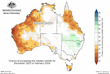
From October, long-range rainfall forecasts from the Bureau of Meteorology began to show a more mixed outlook for rainfall.
While long-range forecasters are usually very good at predicting the average conditions over a given period, it is much harder and perhaps even impossible when looking weeks or months ahead to predict when and where extreme events including very intense downpours are going to strike.
Our weather and emergency services, including the Bureau of Meteorology, do a remarkable job of bringing us the information we need to plan our summers and stay safe. It is essential that we follow the forecasts, listen to the advice, and heed any emergency warnings. This is especially true if we are traveling and in areas with which we are less familiar.
But aren’t El Niño events supposed to be dry?
An El Niño event typically means reduced rainfall for Australia through winter and spring, particularly for the eastern and northern parts of the continent.
However, one El Niño event can vary considerably from another. These events co-exist with many other factors driving our weather.
For example, warm waters in the eastern tropical Pacific mean an El Niño event typically shifts rainfall away from the western Pacific and eastern Australia. However, in recent months waters have also been unusually warm along the east and southeast of Australia. This may have partly suppressed the drying effect we normally associate with El Niño by helping create conditions for rainfall across the east and southeast.
Current conditions are also being shaped by winds south of Australia.
The Southern Annular Mode refers to the north-south movement of the strong westerly winds that blow almost continuously in the Southern Ocean. If those winds are further south in summer, this tends to increase the chances of above-average rainfall for eastern New South Wales, southeast Queensland, and eastern Victoria.
Looking back at the heavy downpours and floods of recent weeks, there are some other important things to bear in mind.
The extreme rainfall and flooding that ravaged Far North Queensland in mid-December was associated with Cyclone Jasper. While we typically see slightly fewer cyclones in the Australian region during an El Niño event, each season still brings the chance of a destructive landfalling cyclone.
Notably, the heavy rains and flash floods that wrought havoc over the Christmas break were associated with severe thunderstorm systems. The different phases of the El Niño Southern Oscillation do not appear to influence the likelihood of thunderstorms. It is thunderstorms that drive many of the extreme and dangerous downpours and flash flood outbreaks, so we always need to be prepared for the possibility of heavy rain.
Overall, since Australia is a relatively dry continent, it only takes a few wet weather systems and rainy days to tip a month or season into being wetter than average. Or for a period we’re expecting to be dry, to end up feeling much wetter. Scientists are more confident in associating a La Niña with unusually wet conditions than they are associating an El Niño with unusually dry conditions.
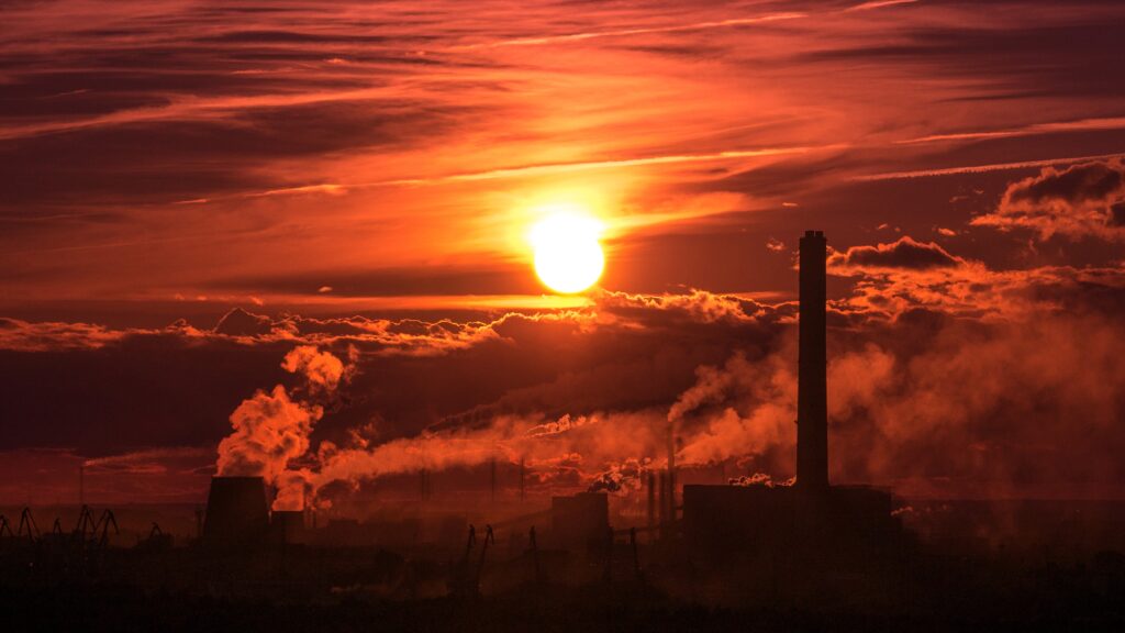
What about fire risk?
Three years of La Niña conditions and above-average rainfall have led to huge growth in vegetation across much of Australia, leaving many areas primed to burn.
September and October saw enormous fires rage across the Northern Territory. Down south, fires began unusually early, with major blazes in Gippsland in early October, and severe outbreaks on 31 October in New South Wales and Queensland. In November and December, many suburbs around Perth were affected by large fires.
The Seasonal Bushfire Outlook for Summer 2023, issued by The National Council for Fire and Emergency Services showed increased fire risk for large areas of Queensland, New South Wales, and the Northern Territory, as well as locations in Tasmania, Victoria, South Australia and Western Australia.
Recent rains have dampened the fire risk in some areas but large swathes of the country, in particular the west, have remained dry. For those that have received rains, the warm weather means the landscape can quickly dry out again, with even greater fuel load. There is never grounds for complacency over the Australian summer, and we urge everyone to make sure they understand their local risks.
What should we expect for the months ahead?
The long-range forecast for January to March is currently forecasting above-average rainfall for the south-east of the country, meaning those in Sydney, Melbourne and Brisbane will likely continue to see a fair bit of rain.
Both maximum and minimum temperatures are expected to be above median for most of Australia, so there are likely still some intense heat waves to come.
Are we seeing the influence of climate change?
While it may be feeling a bit different from the summer we were expecting, recent events nonetheless show many hallmarks of a warming planet.
Intense downpours
Much of the flooding in recent weeks has been the result of short, intense downpours. It is these that can catch communities off guard and lead to dangerous flash flooding. These are also the kind of downpours that are becoming more intense due to climate change. For every one degree Celsius of warming, air’s capacity to hold water vapour goes up by about 7 percent. An atmosphere with more moisture can produce more intense downpours.
High temperatures, despite the rain
Through December, despite the wet conditions, the backdrop of a fast warming planet meant that maximum temperatures were well above average across much of the country, including northern New South Wales and southeast Queensland. While not as hot as the record breaking December of 2019, maximum temperatures were 1.92°C warmer than the long-term average, and the mean temperature for eastern Australia was half a degree warmer than during the last El Niño.
An unusual and highly destructive cyclone
Cyclone Jasper was unusually early for a landfalling cyclone during an El Niño event. And while it was only a Category 2 storm upon making landfall, its slow movement, long life, and ability to dump enormous amounts of rain, were consistent with what we have been warned to expect of cyclones on a warming planet.
What can we learn from the 2023-24 summer so far?
- Everything we experience today is on a planet made hotter by the burning of coal, oil and gas. Our weather is more extreme and erratic. When storms develop they have the potential to become more destructive.
- Extreme rainfall and flooding is possible in any year, even if the climate drivers including El Niño have loaded the dice towards drier conditions. We always need to be prepared.
- While recent rains have lowered the immediate fire risk in some eastern parts of the country, there is no grounds for complacency and it is only a matter of time before we see a return to very dangerous fire conditions.
- Always stay up to date with the latest weather warnings.